A Chronological Sequence of Information on its History.
The Railway Hotel was almost certainly built as a private house, probably in the 1820’s – although there is a reference to the house being built in 1810. Originally it was called ‘Corunna House’, named after the battle of Corunna during the peninsular war where the British helped to prevent Napoleon occupying Spain and Portugal. In this battle, the heroic British commander Sir John Moore was killed. However, no connection can be found between Sir John Moore and the locality so the name may have been simply a patriotic gesture.
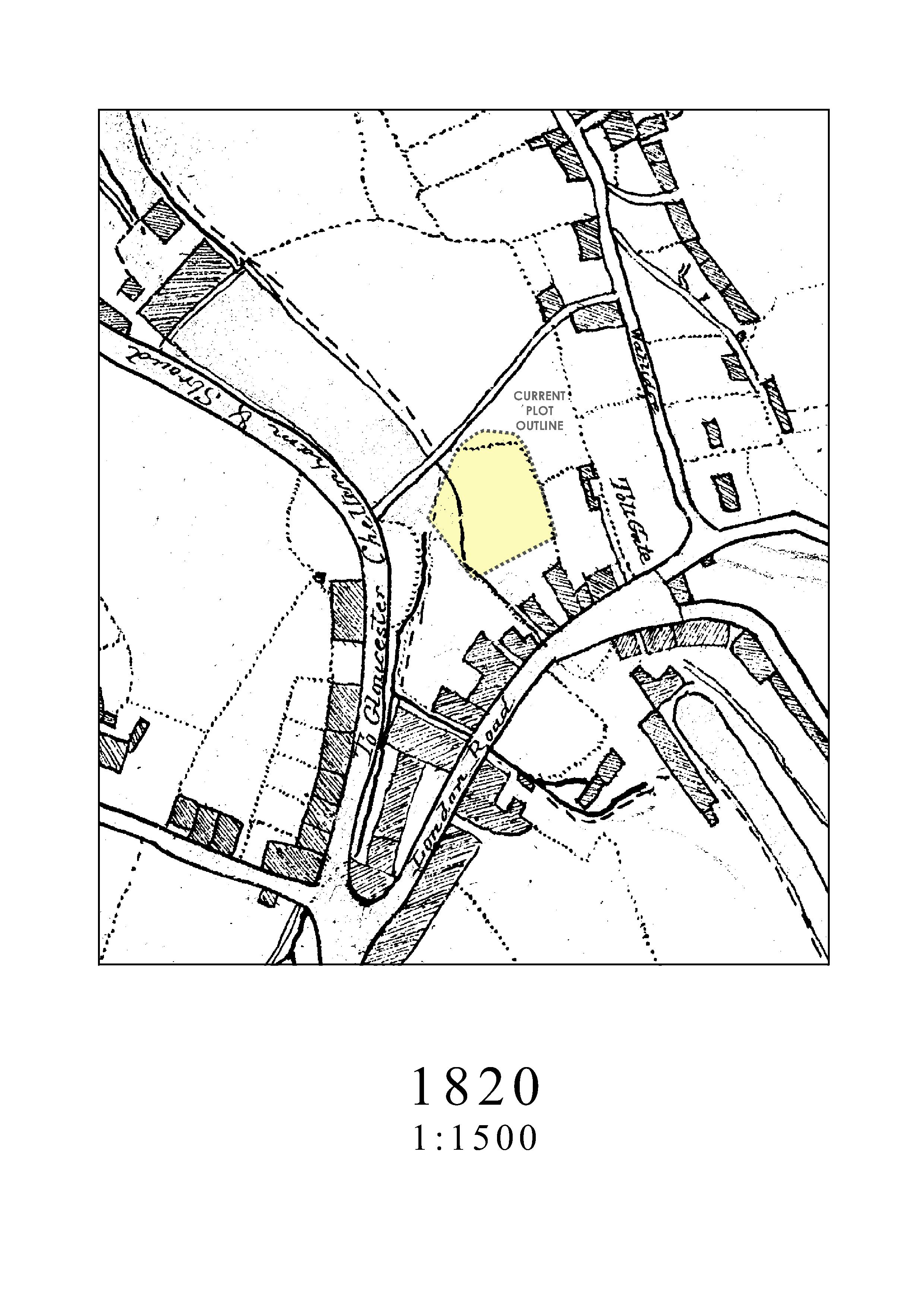
The map of 1820 shows no house and the access, now Station Road, as a path to Watledge where it still today emerges as a footpath. The house is sufficiently grand that it should have had carriage access but the Watledge path ran over a substantial section of Egypt Mill pond and so it is difficult to see where wheeled access went. A present path to London Road may then have been wider. The river courses seem to have shifted around in this area as the mills developed, but the present house curtilage fits reasonably well in the crudely drawn boundaries of the map. Information has been found identifying the owner and builder of Railway Hotel as the son in law of the successful owner of one of the Nailsworth mills that lay close by. This is detailed later.
1820
Corruna House is believed to have been built around 1810, by Edward Bernard, the son in law of John Heskins, owner of Nailsworth Mill. However the 1820 map does not show a property on the site. It is believed that Edward Bernard committed suicide in the property when the business failed and Nailsworth Mill was sold on. In 1839 the Minchinhampton Allocation map registers the property as Plot 907 – House and gardens, however it is believed that the property ceased to be a private house in 1841, becoming a Bus and Truck stop. This could explain the single storey wing with a large window and door commanding entry into the rear yard. The property also housed the town hearse, however no evidence that the property was used as “mortuary” has been found.
The ownership between 1841 and 1914 is uncertain as no listings have been found. The Stroud and Mid Gloucester Distribution List for 1914 gives the property as the Railway Inn, owned by John Davis a farmer and bus proprietor. The Stroud and Mid Gloucester Distribution List for 1932 also gives the Railway Hotel’s ownership as John Davis. This business closed in 1938.
The next listing of ownership of the property is in 1958 with the Stroud Brewery Company and it is understood that the property traded as a Public House and Hotel up until the 1970’s. Matthew and Rene Hanratty were registered as the last landlords. The property was then brought by Bevil Seelig who rented the property out as flats. On 17th July 1980 the Railway Hotel was listed (grade 2).
LISTING ENTRY
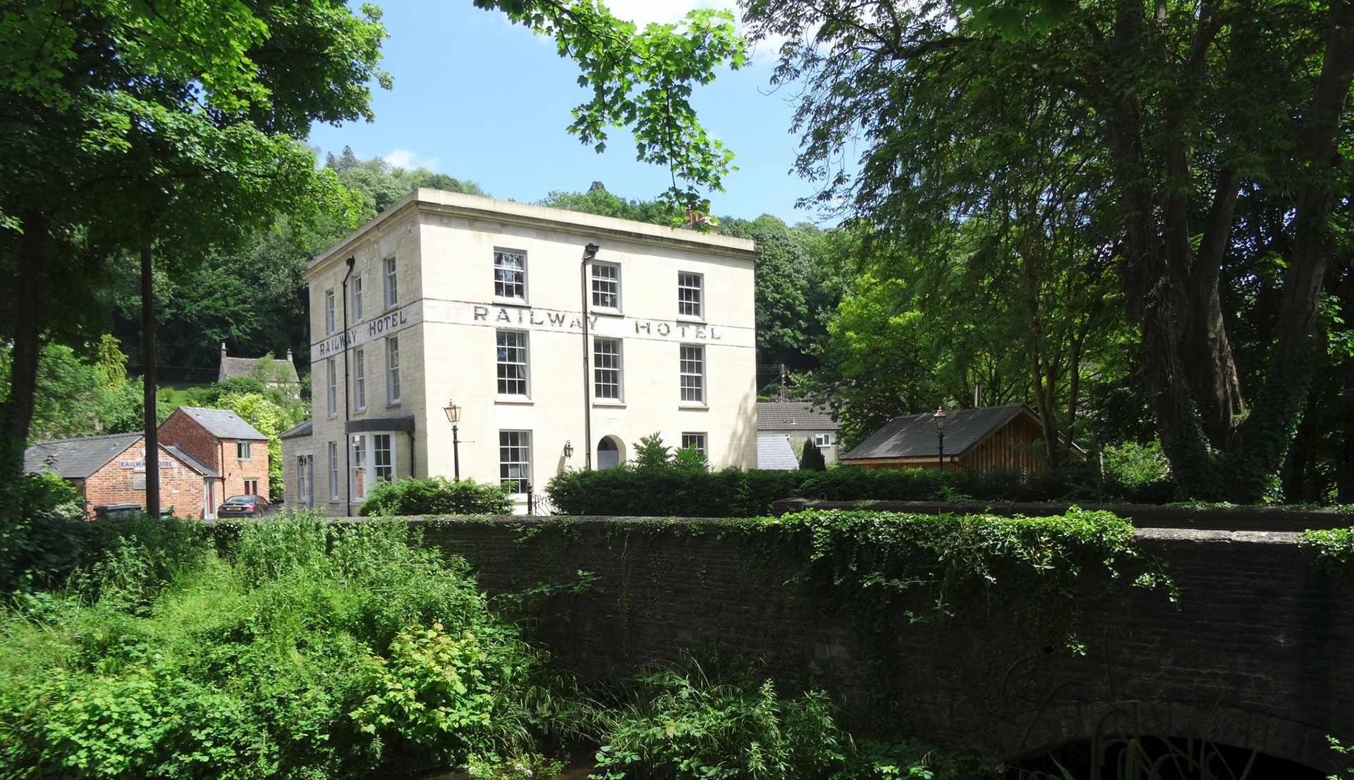
Now a private house. Railway branch line dates from 1864-67. This late classic villa-style house is earlier. Ashlar with moulded cornice to coping. Ripped slate roof. Three x three windows, glazing bar sashes, arched in centre of ground floor (formerly a door as indicated by steps). Ground floor return to left has bow with casement windows. Painted band over first floor to front and to left hand return with inscription “Railway Hotel”. Shown on a mid C19 print of Nailsworth before railway arrived.
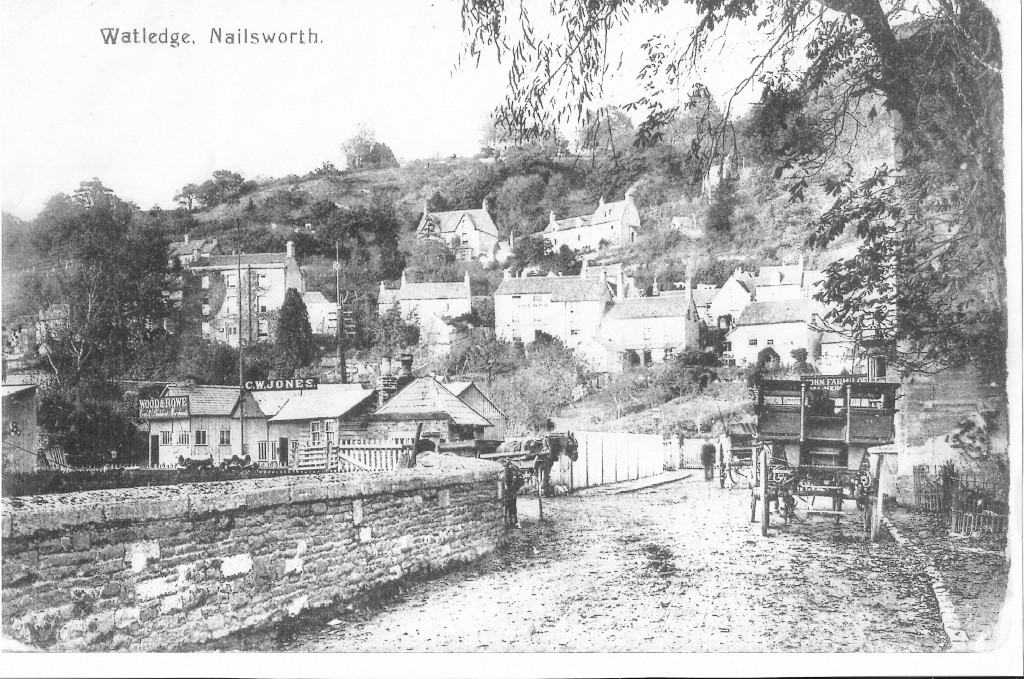
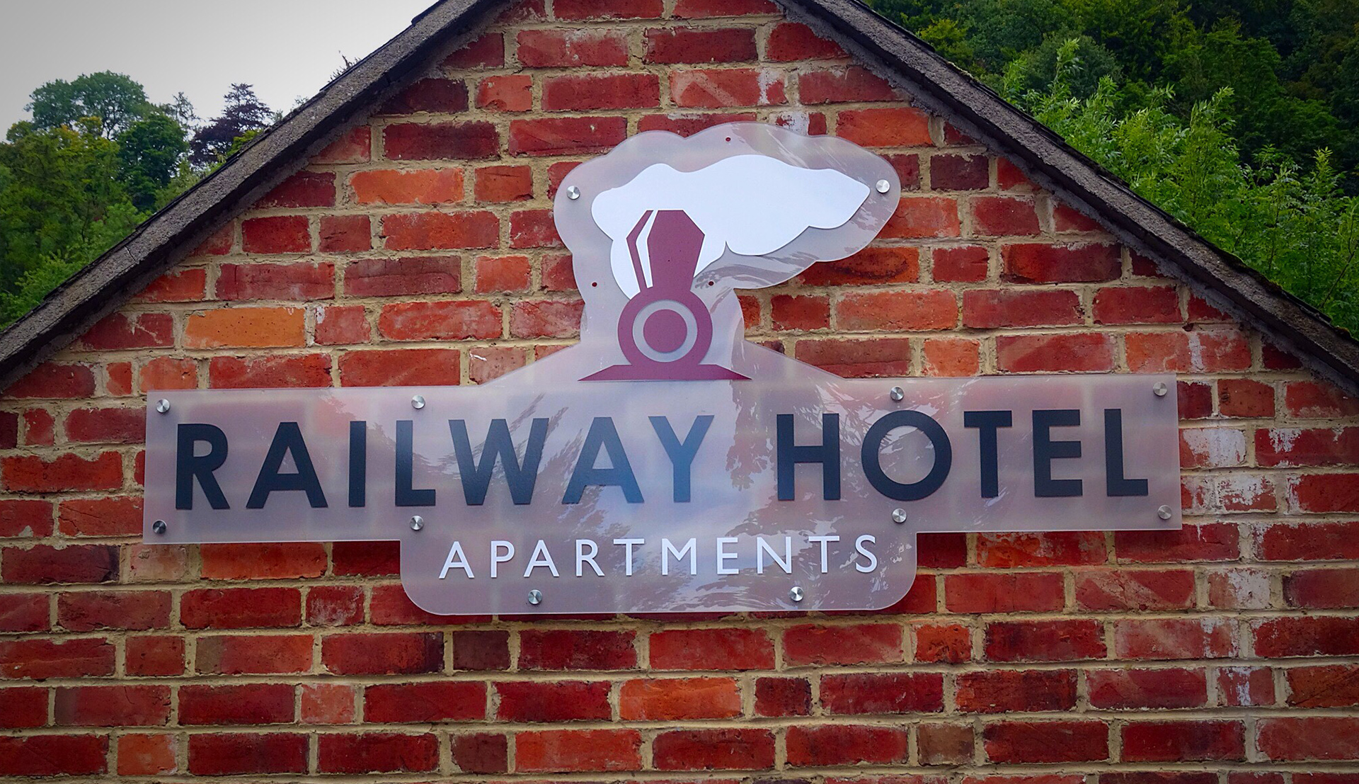
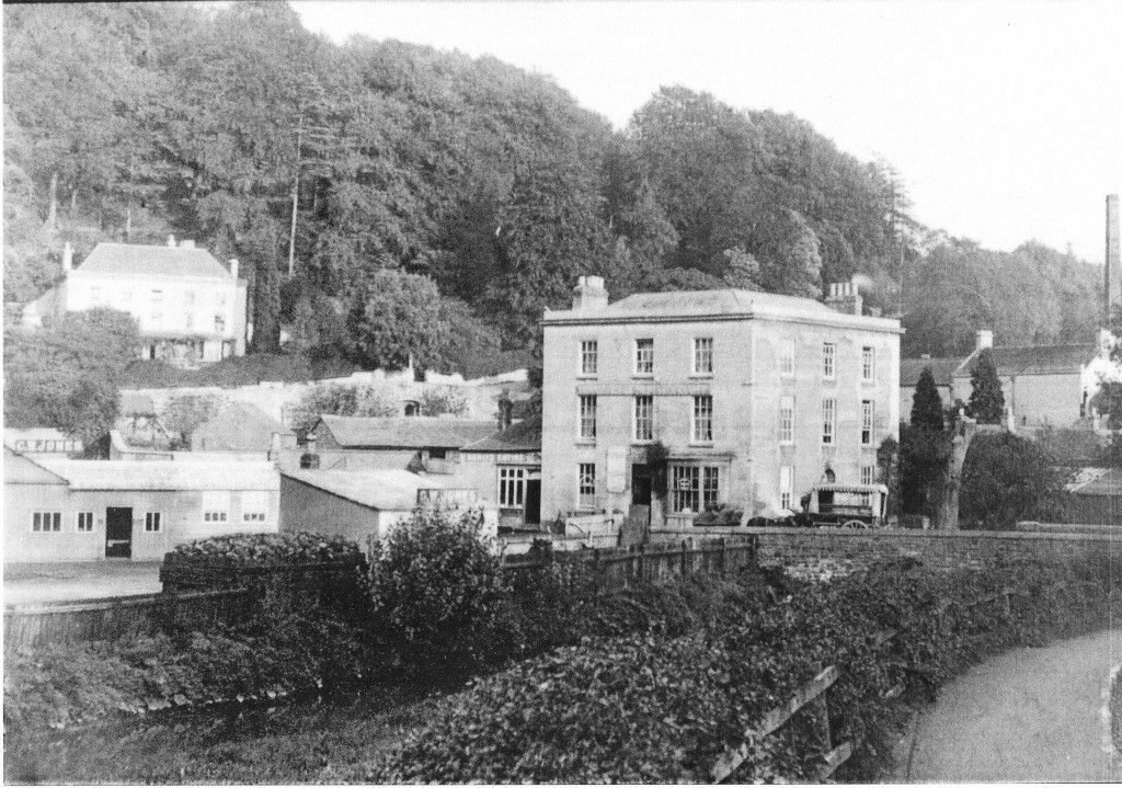
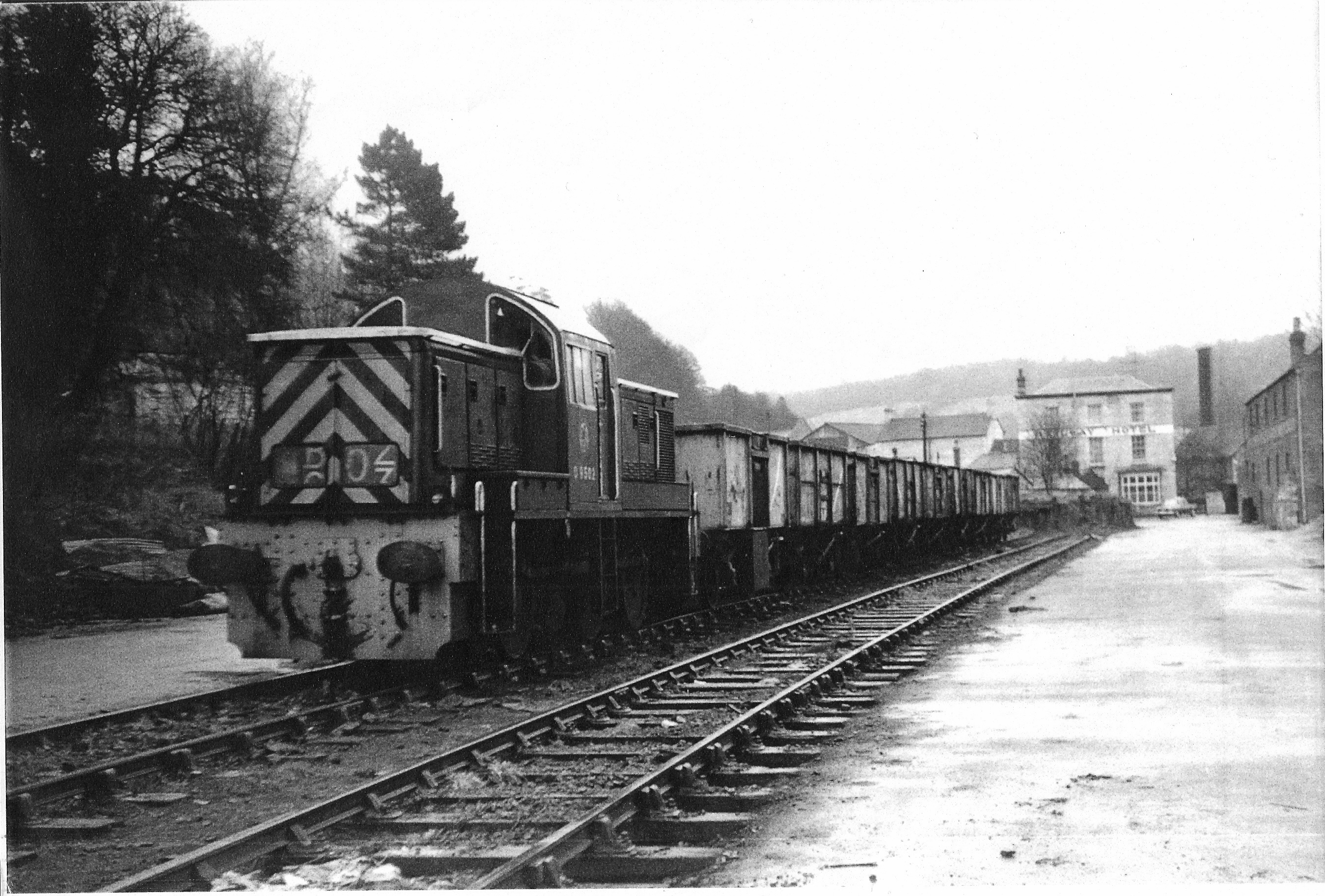
STATION ROAD BRIDGE , RAILWAY HOTEL ON RIGHT ~1905
1839 MAP
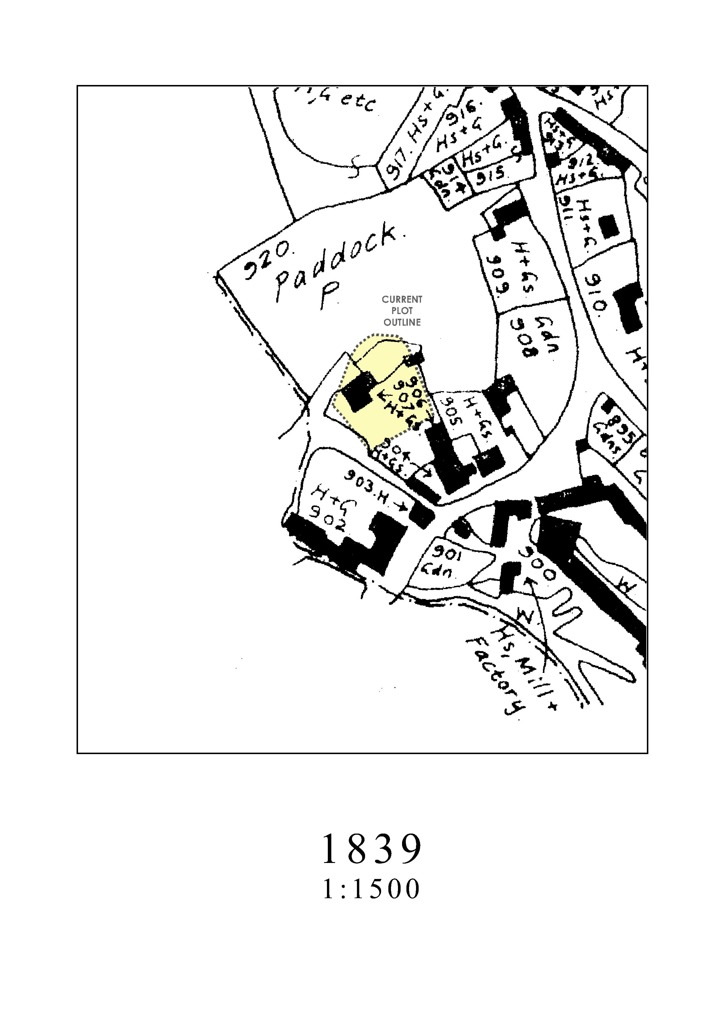
Here the building appears for the first time, although local property boundaries are mysteriously different from the 1820 Map and later ones. The footpath to Watledge is also missing. The map listing as property 907 shows it as ‘H+G’ no doubt House & Garden. The location is certain because of the dotted boundary (parish?) also shown on the 1820 and 1882 maps. Water courses are however a little vague and only sometimes shown as ‘W’.
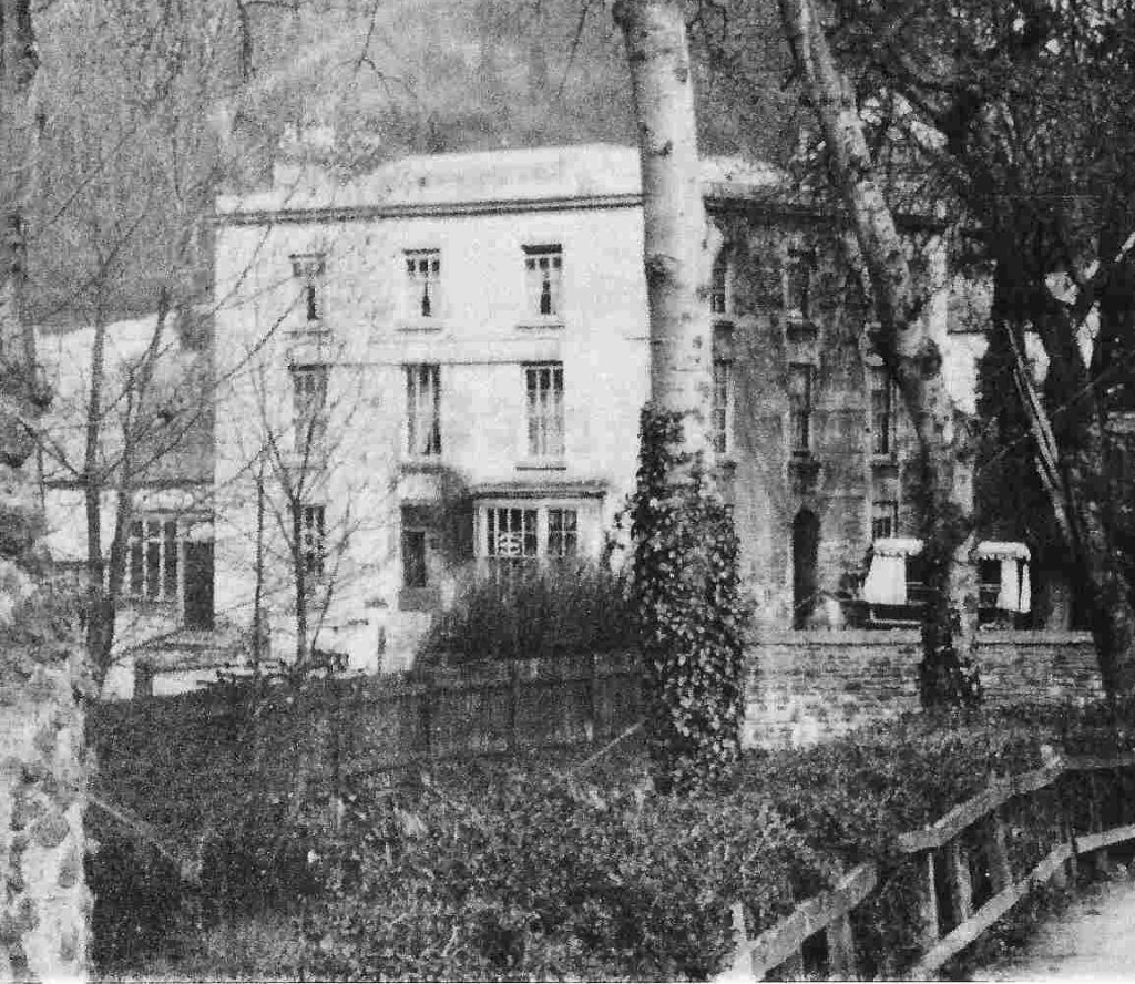
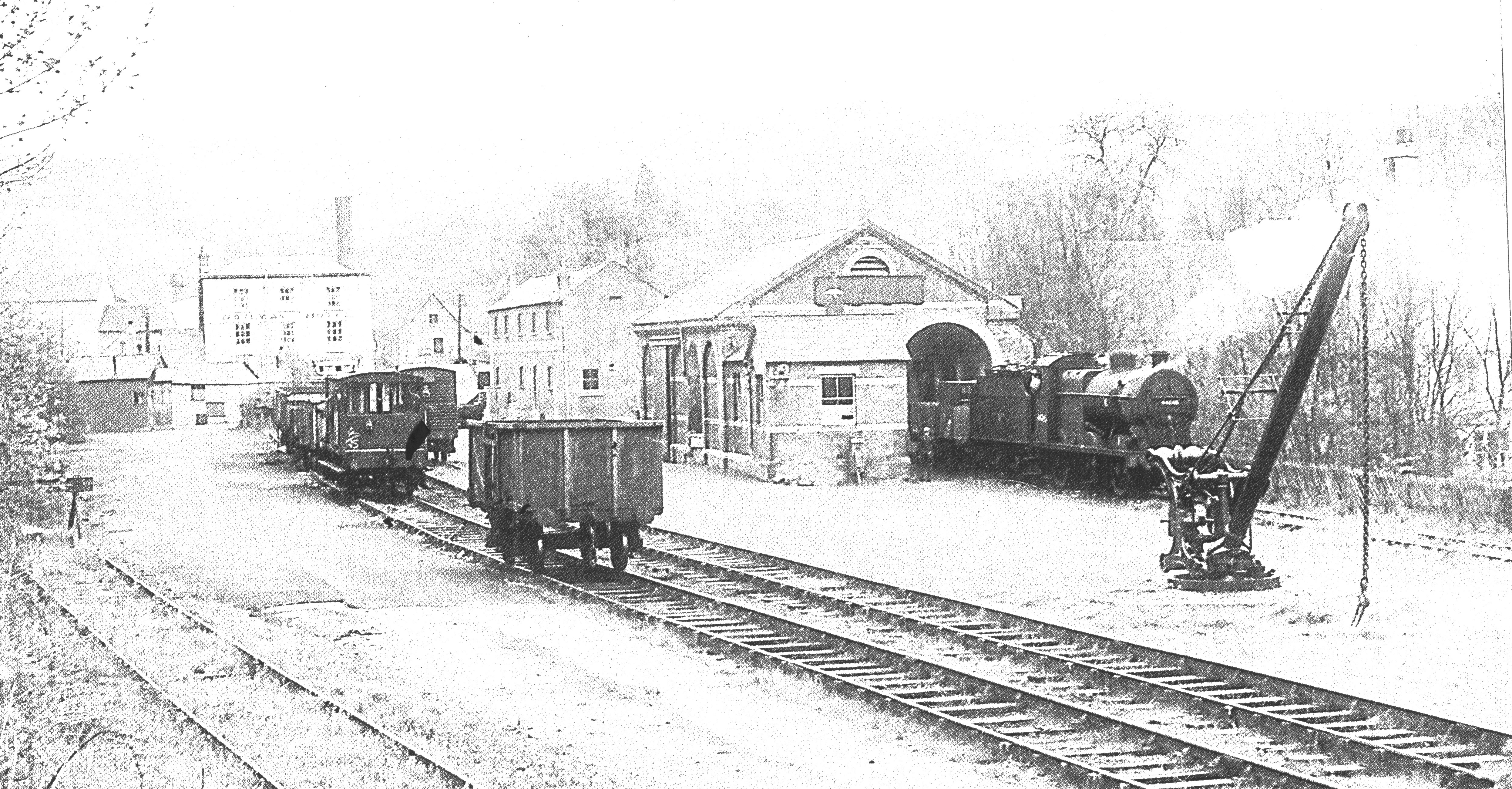
No further maps have been found covering the next 40 years. However three photographs offer intriguing hints of developments (see below). The railway arrived at Nailsworth in 1867, and at some time between then and 1882 (see map) the house became a Public House and possibly an Hotel.
PHOTO 1
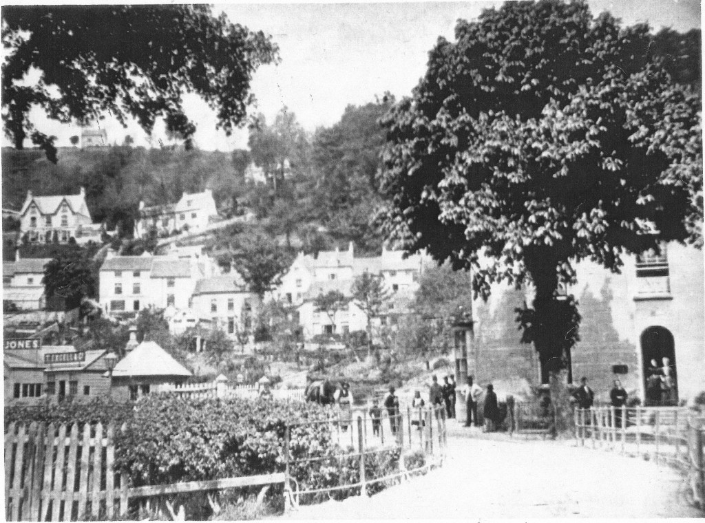
Source: Nailsworth Archives-‘Ann Makemson’, summer, dated 1870.
- A large tree stands in the corner of the ‘front garden’
Apparent public activity and access around the ‘original front door’
Likely railway buildings to the left, including the long lasting CW Jones – Coal Merchant
No bridge parapets, only railings, with a curved road line.
PHOTO 2
Source: Nailsworth Archives-‘Howard Beard’ winter, undated, but note:-
- Stone bridge parapets
The large tree has only its trunk apparent, two conifers stand behind
A covered cart (hearse?) is parked at the entrance
The door on the railway side is apparent and in use with one of two leaves open
The ‘original front door’ is still apparent
A large unintelligible sign on the façade implies a public rather than a domestic use
Railway buildings are more certain and an engine buffer-stop is seen on the left.
PHOTO 3
Source: Nailsworth Archives-‘Howard Beard’, summer, undated, but note:-
- The large tree is now seen polarded or re-polarded, conifers remain
Roadside trees are felled
An identical covered cart is again parked at the entrance
Two large unintelligible signs on the façade confirm a public use
Otherwise very little has changed; fences, railway buildings, window signs etc are identical.
1882 MAP
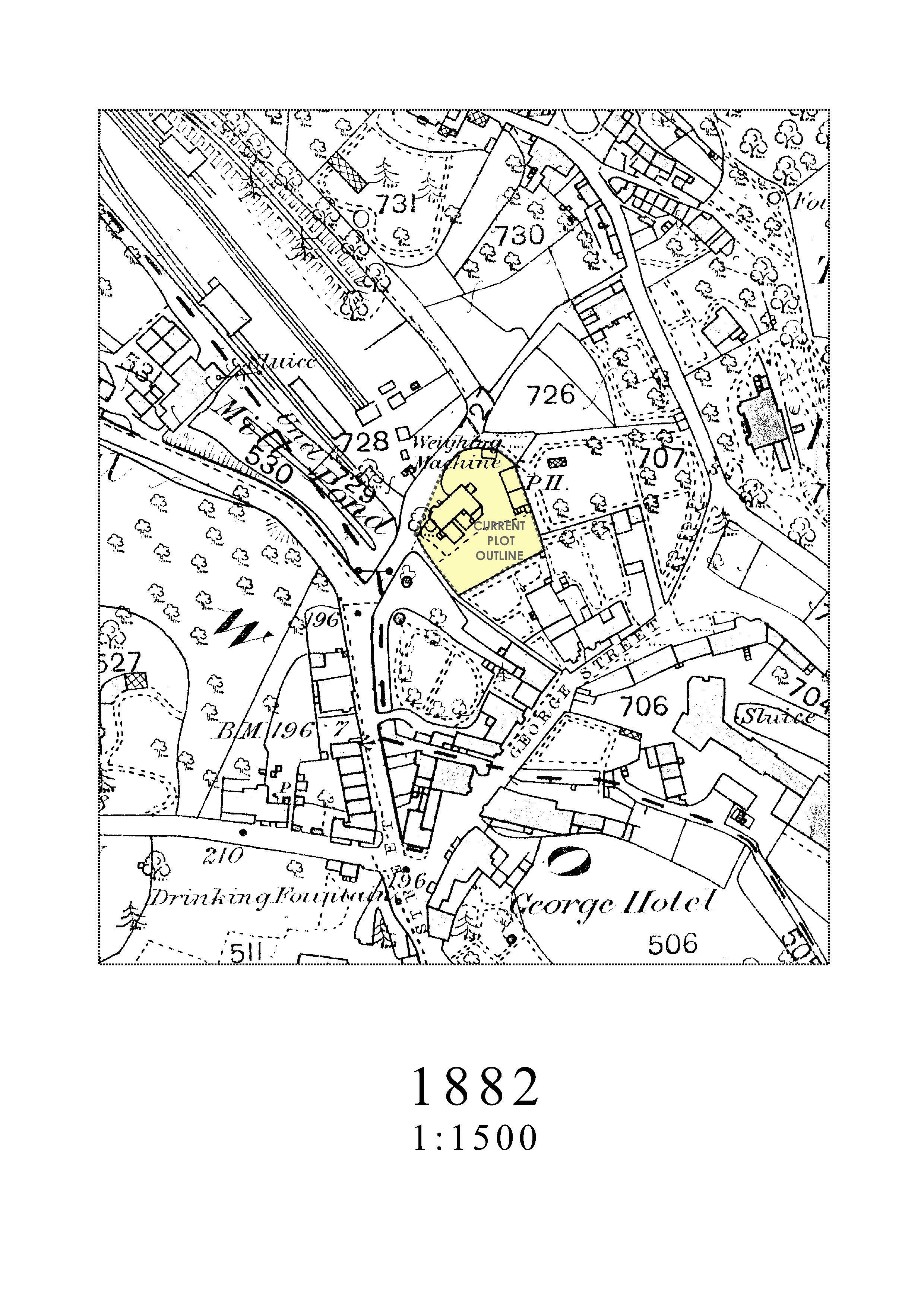
his shows the completed railway infrastructure, including the embankment intended to extend the line on to the South coast. However this is shown with an unlikely collection of trees implying that the original surveying and drawing may have pre-dated the embankment and this was a later edition. Railway Hotel is clearly marked as a Public House. It may also have had some hotel accommodation. The Railway Hotel is strangely drawn, in contradiction of the current ‘L’ shaped plan. No other information concurs with this. Roadside outbuildings are not shown, although they do appear on photographs.
1902 MAP
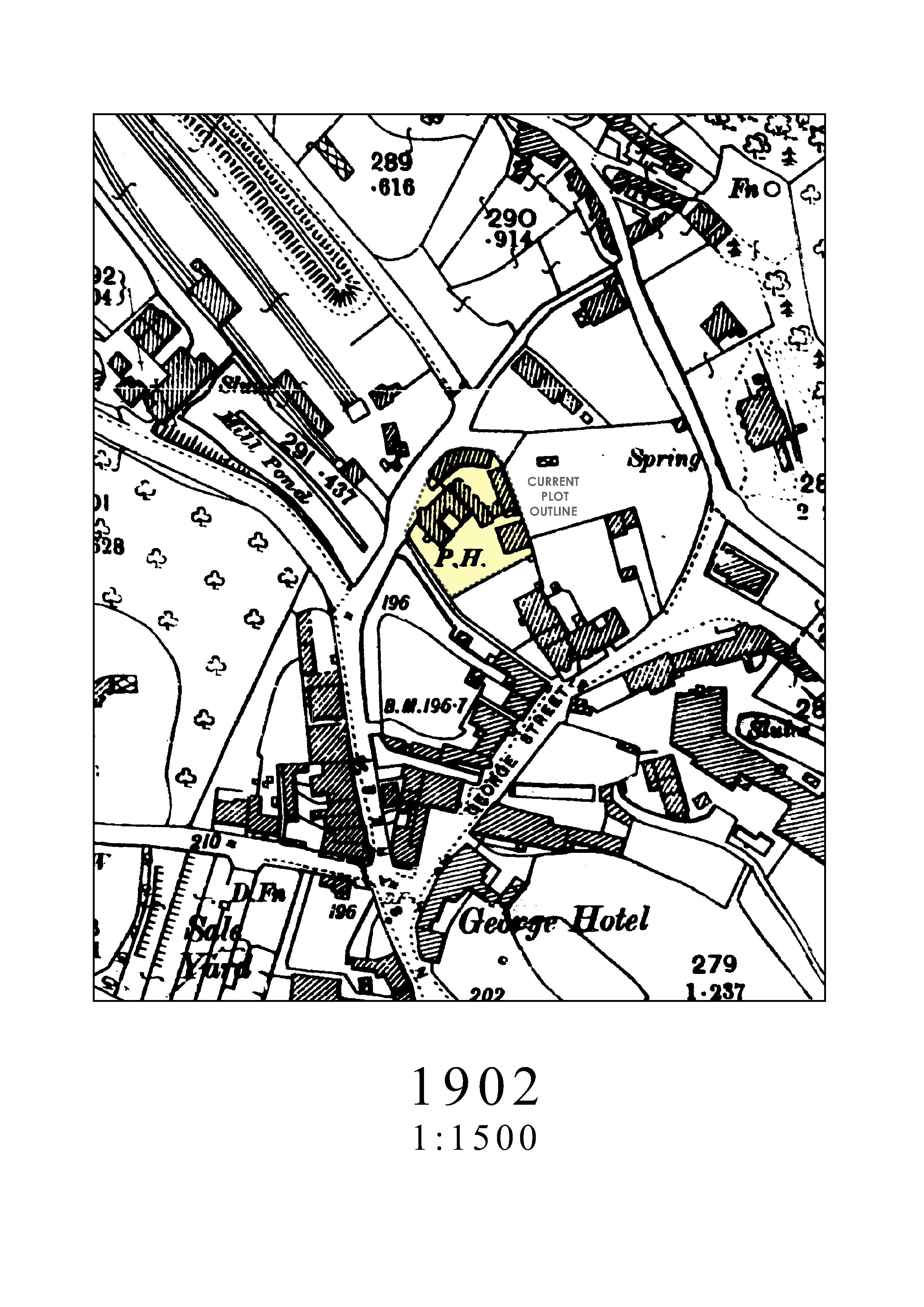
Outbuildings have increased but little else has changed.
The designation is still only PH.
1922 MAP
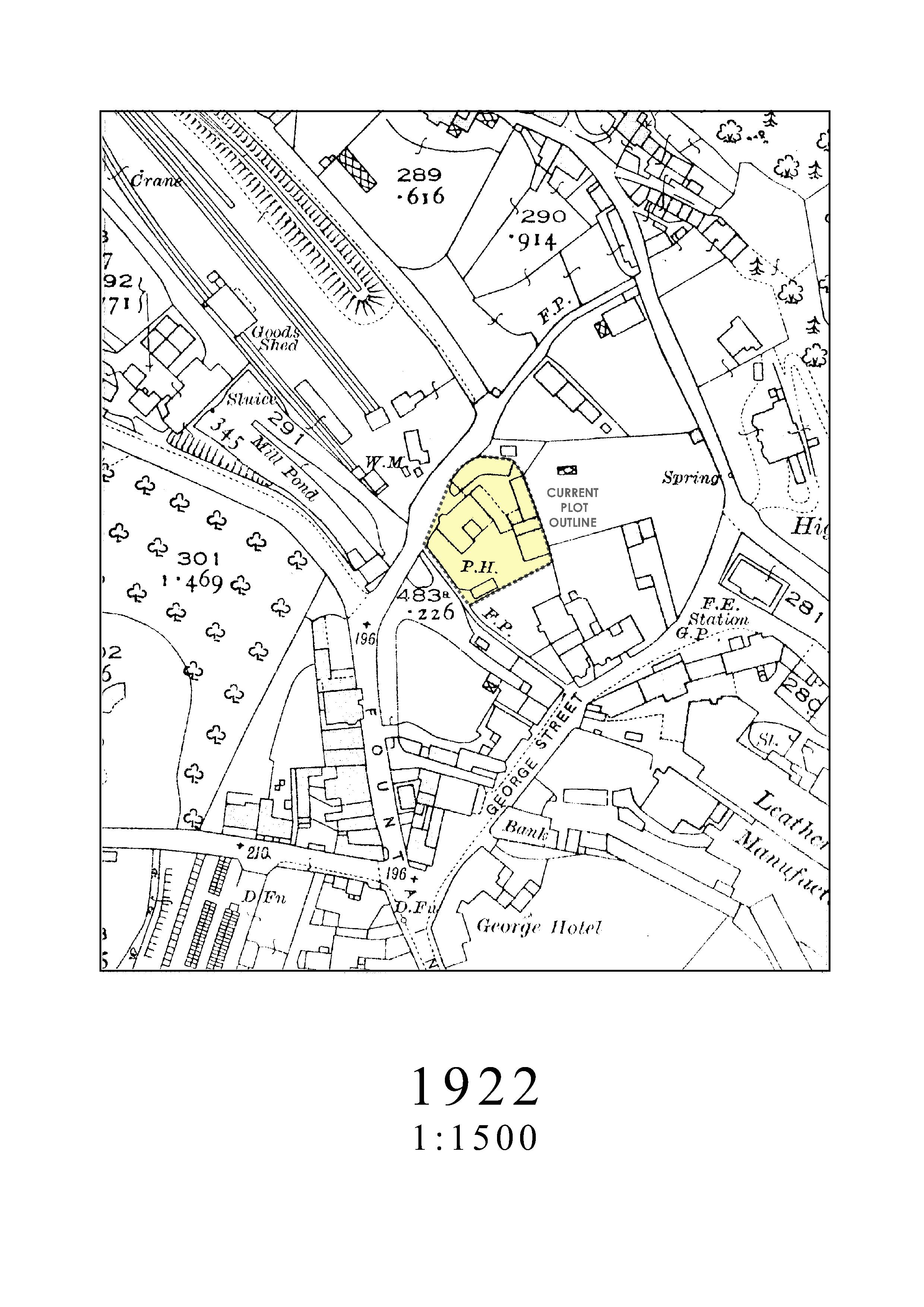
Outbuildings have increased again but little else has changed.
The designation is still only PH.
Egypt Mill pond seems to have silted up a little, so that Station Road bridge, instead of crossing the pond now appears to cross two tributaries or the river as it does now.
Howard Beard 25 9 1956
OTHER 20TH CENTURY INFORMATION
Extensive searches have revealed frustratingly little information, the dates of significant changes are hard to find.
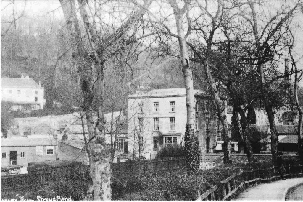
Photographs of the railway frequently incidentally show the Railway Hotel in the background and we include a selection here.
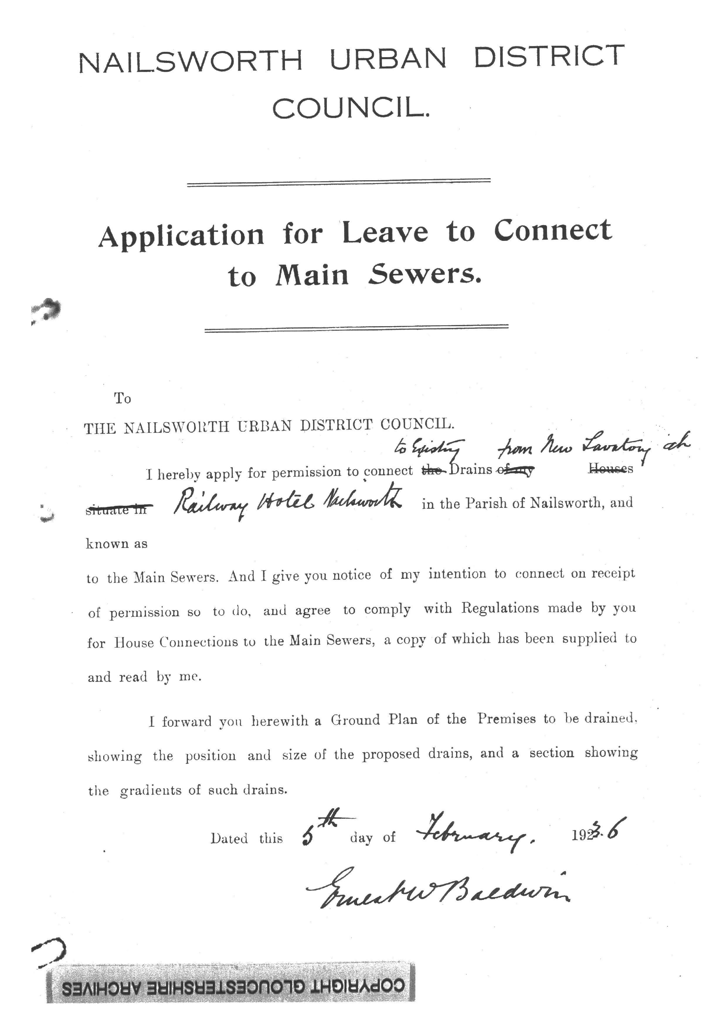
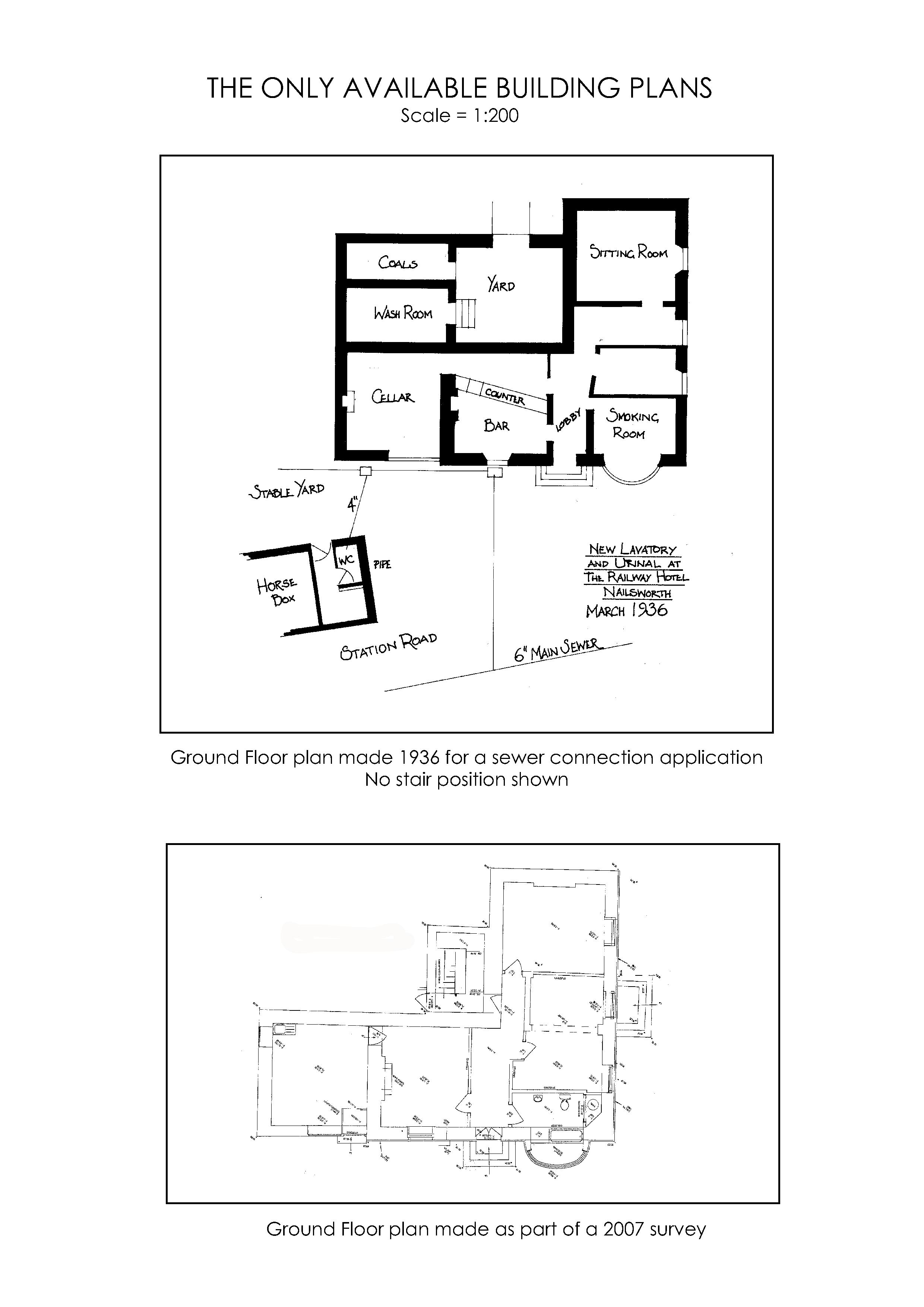
Overleaf a copy of a 1936 application to connect a new WC to the sewer gives tantalising information on the internal layout but no help on the original stair position, which is strangely not shown.
The current painted-on Railway Hotel signs can be seen on a 1936 photograph, so at this date it was certainly an hotel. The original front door appears as a window in the sewer plan so by this date at least it seems as though the access had switched towards the railway completely. The access runs past the bar area enabling staff to monitor all coming and going. The stair could have just about have remained in the area inside the original front door.
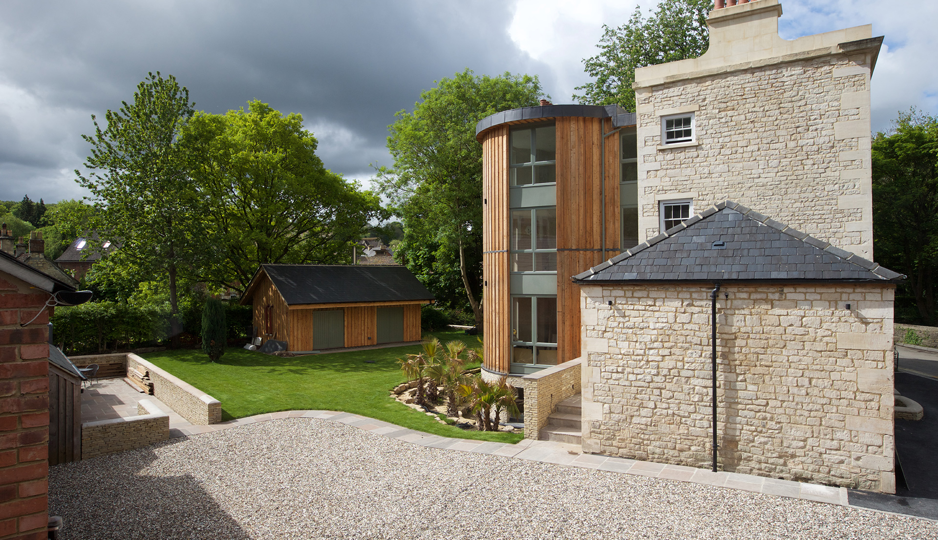
It is hoped that more information on the original internal layout will be revealed by repair and alteration works.